Wednesday, July 16, 2014

Colorado to Oregon

WY Cattle move
Grand Tetons, WY

Grand Teton National Park

Nuclear Rods by Breeder

First nuclear powered electricity facility; Idaho

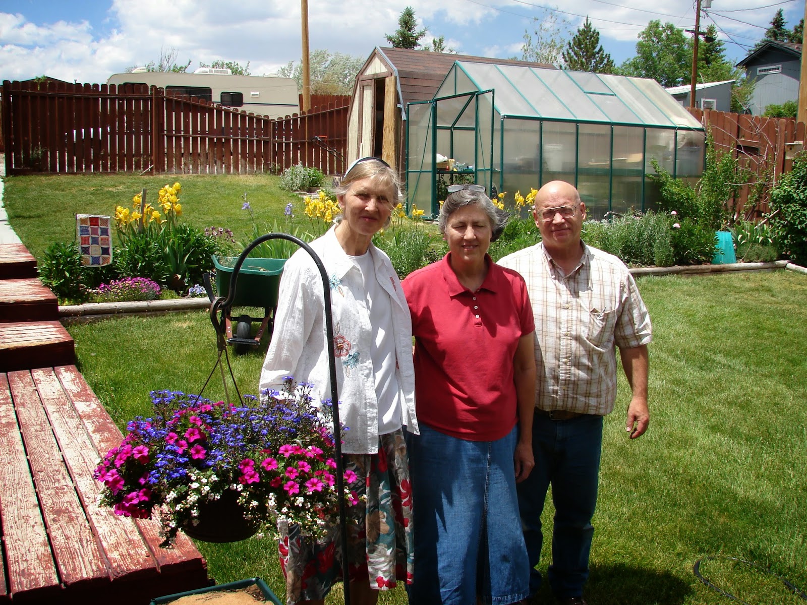
Doug & Twila Wright Ward, Roger Wright, Christine
Craters of the Moon, Idaho


We arrived at my brother Gary's home in Newburg, OR yesterday. We dipped our feet in the Pacific Ocean this afternoon for the second time since the beginning of our trip and have enjoyed riding through beautiful forests of the Oregon coastal and Cascades ranges and the agricultural diversity of the Willamette Valley. We have traveled around 8400 miles so far on this trip and will have logged close to another 4000 miles til we get back to Virginia in another month. We have visited between 15 and 20 national parks and monuments, spent the night in at least 20 Walmart parking lots, and a dozen or so national park service managed campgrounds. A half dozen or so times we have camped at roadside pull offs or vacant lots. We have used motels about a half dozen times. We have stayed at the homes of relatives and (or) friends a dozen times and counting. We have yet to use a KOA or other privately owned RV campground and probably never will.


Highlights of the past two weeks have been a weekend spent at a Mennonite Central Committee Bolivia reunion where we reconnected with friends we haven't seen for 40 years; hiking and viewing snow fields, a profusion of wild flowers, and elk herds on alpine tundra above 11,000 feet altitude; several nights spent in the homes of friends; and chance encounters with local folks in small towns, learning about local events and issues. We have learned a lot of history about diverse things like the first nuclear power plant to generate electricity in Idaho, the hardships of wagon travel along the Oregon Trail 150 years ago, and the realities of modern day cowboying and range management. It's these kinds of things that make an extended trip personally enriching with lots of cherished memories.


CO, Black Canyon of the Gunnison

Black Canyon

Tuesday, June 3, 2014

Sequoia National Park to Hoover Dam

Beauty in Sequoia National Park
Sequoia Trees
They grow up from a seed the size of a dill seed


View of Sierra Nevada Mountains from Moro Rock


We Were Way Up There!
Driving to Sequoia National Park yesterday, we drove by groves of orange trees.  So we could see green again.  At Potwisha Campground we were surrounded by steep peaks, but most of them were green except for rock out-croppings, and the distant Sierra Neveda peaks.
This morning we drove up and up from 2,500 feet elevation to about 4,000 feet at the museum where some of the first giant Sequoia trees were standing.  We had to look up 250 feet to see the top of many of those Sequoias.  In the afternoon we boarded some shuttle buses and did some hiking from drop off points.
Moro Rock looks like a bald granite head on one mountain peak.  We walked way up there to the top—6,725 feet up!  I kept thinking that the railing and stairs would stop, but they kept going up and around.  While climbing, we could look down in the green canyons and up to the Sierra treeless and snowy peaks.  At the very top of Moro Rock, I saw this fellow, with a hard hat, on the other side of our handrail.  I wondered whether he was a workman; as I knew we tourists were to stay in the walkway.  There he was sitting on a rock, pulling on this rope which was attached to the rail (and to himself).  The other end disappeared over the edge of the rock.  Marlin and I threw out many questions.  Was he climbing up or down the rock?  Was he by himself? How soon would his buddy appear?  Marlin waited with camera in hand to photograph his buddy when he emerged.  I offered him a granola bar and to send them a picture, but he refused both.  So I cheered them and forgot about my conquest of the climb to the top.
So today we were way up high and looking up at God’s creation.  Two days ago we walked and looked down at Hoover Dam marveling at man’s creation.
“So what is man…?”
Hoover Dam as seen from Route 93 bridge
Bridge and electrical towers seen from Hoover Dam

Wednesday, May 28, 2014

Grand Canyon to Willow Beach campground near Lake Meade


Desert view on the way to Plateau Point


Grand Canyon from the rim


Grand Canyon in all its splendor


So, the mountains look like piles of dirt.  Is this what the children of Israel wandered through?  As we were driving out of Prescott, AZ this morning, I decided to check out where we might spend the night.  Tony Brazeau had told us that Lake Mead National Recreation Area was a good camping area.  I saw Willow Beach campground not far off of 93 and just 25 miles south of Hoover Dam.  After telephoning, I found out that we would not be able to camp at a tent site; however, our senior National Park pass would allow us to have an RV site for $18.50.  So that seemed to solve our night’s lodging needs.
We got on Old Route 66 in Seligman and drove to Kingman.  There were some old cars, shops selling Rt 66 memorabilia, and small houses in the town of Seligman where we got on 66, but most of the time we drove along scrubby fields,  read "Burma Shave" signs, chased a long train running parallel to us, and viewed the mountains bordering the horizon.
We got on 93 N.  Driving went well for Marlin with the help of a little tail wind.  I was dozing off.  At one point, there was a big metal arch over the road with a black blank sign at the top.  It seemed like that should be the NV state line, but we didn’t see any state signs.  Shortly thereafter Marlin says, “It’s only 20 miles to Hoover Dam.”  That woke me up; so I started reviewing my maps and watching road signs.  Pretty soon we saw a Lake Mead National Recreation Area sign.  The mountains of black dirt seemed to close in around the road.  Then we saw the “Willow Beach” sign pointing to the left.  No river or lake seemed close, but we believed the signs and there was one road in front of us descending between the mountains of dirt.  No green was visible, but after about 5 miles, the river/lake, boats, cars and a building were in front of us.  So for the first time we are at an RV campsite with electric +.  It is hot on this dirt hill, but we have water, bathrooms, and shower facilities beside our camper and almost to ourselves.
So the West still impresses us with its vast amount of wasteland; however towns like Prescott Valley and Phoenix are growing rapidly.  Because of the cooler weather, towns like Flagstaff and Prescott are popular places to build on the hills.  You should see the boulders and rock piles on which lovely houses are built on in Prescott.  Evie loves her “wild life and plants” around her house.  Many birds eat from her feeders.  The javelina (wild pigs), deer, and ground squirrels freely roam around her house.
Cousin Evie Peck's home in Prescott.AZ


We hope to keep trekking and eventually travel back home to the green hills of the Shenandoah Valley and to you our friends.
So Long,
Christine

Friday, May 16, 2014

California Ocean to Neveda


June 9, 2014


I have just realized it has been a while since I last updated! I guess we are having so much fun I am not keeping up.

We saw the giant Sequoias and they defy description! We did a quick in and out of Yosemite because we had not been able to secure a campsite in the park, got there too late in the day, and were a bit put off by the crowds and congestion. We did enjoy our brief stay, however, and got some nice views and pictures. I would have loved to have had time for hiking. 
Yosemite National Park

Once out of Yosemite we headed towards Santa Cruz and found a campsite at Big Basin Redwood Park. The old growth redwoods were just as impressive as the giant Sequoias in their own way. Almost as impressive were the other tree species such as Douglas Firs and Ponderosa Pines.


We then hit the Pacific coast a little north of Monterey Bay, CA and drove up Route 1 towards San Francisco, stopping several times to walk beaches, wade in the surf, and watch surf boarders. Several times we stopped to buy fresh fruit at roadside stands. We stealth camped once along Route 1 in earshot of the sea. There was a nice late afternoon stop at a lighthouse in process of being restored.


We basically skipped San Francisco. Yes we drove right through the city to Golden Gate Park with me seeing mostly stoplights. We found a free parking spot near the bridge and hopped on a free shuttle bus to ride around the Presidio Park section of the city. We walked several trails to cannon battlements set up along the bluffs during the mid to late 1800s to defend the Golden Gate harbor. 
We then walked down to Fort Point under the bridge and toured the massive brick structure where munitions were stored and loaded during the civil war. After that we walked up onto the Golden Gate Bridge and I walked half of its length, marveling at its mass and the engineering involved in its construction.

That was plenty for us to see in one afternoon and we decided to get the heck out of San Francisco before nightfall as some of our plans had fallen through, we were unable to secure an economical place to spend the night, and were not willing to deal with all the expenses of lodging, eating, and getting around San Francisco. Big cities are just not our thing!
Golden Gate Bridge

Since leaving San Fran we started eastward and spent a nice afternoon and night in an old gold mining town (Placerville, CA) during the 49ers era, went to church there next morning, and drove on through stunning mountain scenery to Lake Tahoe. We camped there last night at Fallen Leaf Campground and spent some wonderful time wading in the lakes and enjoying the 7000 foot elevation lakes, forests, and distant snow covered  peaks.

We are now headed east through central Nevada and back into desolate desert. We plan to get an early start in the morning before it gets so hot and we are going to fill up with gas including the reserve 5 gallon jug in the rear of the camper.  Looking forward to spending time with Roland and Leanna Good and the Eureka Church.
At least there is sage brush on some NV Bureau of Land Management lands


            Christine with Leanna & Roland Good

Marlin
Top of Form

Bottom of Form

Arkansas to New Mexico IMPRESSIONS

We are definitely in the West! We watched the progression of the great plains of Kansas change from tall grass prairie (dominated by large scale center pivot irrigation agriculture) to short grass prairie (dominated by cattle ranching) as we rolled through that state. Midway across we skirted thunderstorms to our north and found out later that there had been tornado warnings out and at least one confirmed touchdown. 

Soon after rolling through the Oklahoma panhandle and into New Mexico we camped overnight at  Clayton Lake State Park.  We were surprised to be able to walk to see uncovered/preserved dinosaur tracks by the lake. The cool temperatures of that night continued as we drove towards the Rocky Mountains.  While ascending the mountains we encountered snow!  Up to five inches accumulation of snow on the ground (but none on the roadway) made for safe driving and stunning views.

We are now visiting one of Christine's nieces living near Farmington, NM and filling up on Mennonite home cooked food and taking hot soaking baths.   I can't imagine how anyone can do much farming in this land of rocks, sagebrush, and scrubby juniper; however,  we can see how the desert blooms (here at Paul & Diane's) with water irrigation from the concrete ditches.  (They pay $500.00 @ season for irrigation water.)

Marlin

Water is the life blood of making the desert bloom.  Adin Gingerich was the first Mennonite here (42 years ago).  He told how his parents and other Amish families were lured to NM to buy land which supposedly grew 4-5 foot high wheat.  His parents came, but they didn't irrigate.  They couldn't even afford to pay their land taxes; so they gave their land back to the county and moved out of NM.  Currently land (in Paul's area) is selling for around $20,000.00 @ acre.  Is this because the Bureau of Land Management owns so much of the land and oil pumping and refining is the big business here?
So if there aren't irrigation lines, one sees oil pumps and collection stations.
The rivers and lakes are are still ultimately dependent on rain fall and snow melts.  Clayton Lake State Park did not have enough water for boats for 2 years, but rains this past Fall will allow boats on the lake this season.

There had been miles and miles of fields. 
 I wondered, "Where are the houses and the people?  
In the Flint hills of eastern Kansas, I learned that the land is owned by rich non-local folks.  Cattle are trucked in to graze May through August.

At Clayton Lake, NM the ranger said that he would have liked to stay on his home farm, but it couldn't provide enough income for a family.  The local town used to have a thriving cattle business when there were three big ranchers.  After one rancher bought all 3 ranches, he went broke; so cattle and jobs left the area.
It seemed like there were decaying houses and towns in decline. 
Railroad stations are no longer open in towns such as Mansfield, MO, but train tracks run beside the highway and through the towns.  One moving train had 2 engines pulling 86 cars.  Is J.B. Hunt still operating some of Mansfield's old canneries?  Grain is definitely being shipped from the towns' grain elevators. 

Hugoton, KS was advertised as the Gas Capital.  A local policeman said their claim was for natural gas, but the local supply is almost depleted.  Currently fracking seems to be very active in southern New Mexico.

Christine

Sunday, May 11, 2014

April 29 2014


This was our first stop near Cary, NC to visit Christine's sister Darlene and Charles Saunders.  We went to church with them on Sunday and Charles and I spent much of the afternoon flushing out the plumbing in the coach and trouble shooting the electrical system.  He found a defective breaker switch which throws juice to the interior receptacles after the generator is started and a leak in the on board water tank.  We ordered a new breaker and had it sent to another of Christine's sisters whom we plan to visit in Harrison, AR.  We were thinking of not bothering to carry water in the water tank anyway as that would add weight and cost some gas mileage.

We did a BBB checkup on the guy in Arkansas who was going to repair our refrigerator, and found out that he has a bad reputation, so we canceled plans to go there.  That will save us some significant time and miles and about $800.  We decided that we can buy an awful lot of ice to keep our stuff cold for that money.  We have an extra ice cooler which sits just inside the entrance door and it is fairly easy to catch the melt water from the ice and use it for hand and dish washing.  We carry a few gallons more for drinking water.  It's not working bad at all. 

We camped two nights in the Smokey Mountains and I got in some serious hiking (about seven miles) from the camp ground to the Appalachian trail.  Christine was coming down with a urinary tract infection and was not up to that much hiking.

We spent a full day in Nashville, TN visiting Servant Group International and finding a walk in clinic to get a consultation and antibiotics for Christine.  We were treated to brunch at Cracker Barrel by Bud Driver and he generously gifted us a converter box which plugs into the cigarette lighter on the dashboard and permits us to recharge our computer stuff as we drive.  The following day we headed across Tennessee for the Missouri Ozarks.

We had a great two nights and a full day camping at the farm of Baker Creek Heirloom Seeds and attending their spring gardening and country music festival near Mansfield MO.  There were lots of plants and crafts vendors and a very interesting replica pioneer village with things like a blacksmith shop, grist mill, jailhouse, apothecary, livery stable, country store, etc.  One of the highlights for me was listening to some excellent local old time country music performers.  I even got to play my dulcimer on stage with one of the groups.  We were both quite impressed with the performance of one 88 year old gentleman playing percussive wooden paddles in rhythm with one of the groups.  My how he could make his arms and hands fly!  As we passed through Mansfield we stopped briefly at the home of Laura Ingalls Wilder, author of the Little House on the Prairie series, but didn't tour the museum.  We did visit a historical society museum in Mansfield though.

We spent two full days visiting Christine's other sister Sara, husband Robert Kane, and daughter Winel in the Arkansas Ozarks.  The breaker switch for the generator had arrived so I installed it and got the electrical system for the coach checked out and fully functional.  Christine was still not feeling well (partly side effects from the medicine) and spent the second day with Sara, washing clothes, and working on some computer stuff while I hiked eight to ten miles on back roads in the Ozarks.  I got to chat with several local folks and to pet some dogs.

Our next stop was the Tall Grass Prairie Preserve in the Flint Hills west of Emporia, KS.  This is one of the only places in the west where one can walk around in the midst of native prairie vegetation with few fences and be able to see several miles in all directions of undisturbed prairie ecosystem.  The over 10,000 acres of preserve surrounds an old ranch which was first developed around 1880.  The ranch house, barn, and outbuildings themselves were built of the native limestone and flinty stone and were quite interesting to see from the outside.  Unfortunately the insides of the house and barn were closed to inside tours due to ongoing restoration.  They were surrounded by miles of stone fences.  Imagine a privy with three holes and foot thick stone walls!  One of the bigger disappointments was the prairie grass was not that tall.  Over winter weathering and prescribed burning (prairie fires were part of the original land management) had reduced the vegetation down to six inches to two feet in height.  If we had visited in the fall we would have found 5 - 6 foot tall grass.  Christine and I hiked a loop of several miles out into the preserve.  The views were awesome!

The Flint Hills covers an area equivalent to several counties in size where there are few houses (only scattered towns) and primarily large areas grazed by cattle which are brought in from out side the area to graze during the summer.  The rolling hills are rocky and not suitable for tillage agriculture but are good for cattle ranching.  So the entire countryside for miles around looks much like it did in the days of the old West


Crossing Kansas

Saturday evening we parked at Newton, Kansas Wal-Mart.  In trying to find that, we got into the town of Newton and stopped to ask a gentleman how to find the Wal-Mart.  (His son, who was working on a car, reminded me so much of Scott Campbell. I wish I had asked his name; as I remembered later that Orlin has some relatives in KS.  Well, this man's directions made it possible for us to find The First Mennonite Church of Newton,  this morning.  I told folks there of Mother having a baby at the Deaconess hospital in Newton in 1942, and how that was one of the most enjoyable experiences of her life.  Sure enough, that hospital had been very close to this church and was pictured in their church history booklet.  This was an appropriate day for me to remember Mother and the Sisters at the hospital who served God. 

We have been riding across windy Kansas today.  Marlin had to really hang onto the steering wheel all afternoon as he drove, fighting the buffeting side winds.  This evening we hear that there are/were storms and tornado warnings just north of us and where we were yesterday and today.  Another stress today was that our gas gauge was at empty and we couldn't seem to find gas at the small grain towns.  In desperation, we finally started asking citizens.  A small store owner told Marlin that at the gas pumps where we had looked there was a place where we could swipe our charge card.  So he pumped in 13.8 gallons of gas!  So "thank you Lord that we didn't get stranded.  Marlin, promise me that you won't let the gas get this low again."  I won't make promises, just try to use my best judgement.  Sara said that we should get gas when we see it.  Now she is really going to start haranguing me every time the gas tank gets below 3/4 of a tank, especially if she sees a station where the gas is a couple of cents cheaper.  We did pick up a 5 gallon gas jug to fill up as a reserve when we get into the western states where gas stations may be more than 150 miles apart.  It is a little disappointing that the Toyota only goes 11-13 miles on a gallon of gasoline, but the truck engine has been quietly purring along.  I think we are finding that the lower gas mileage is mostly going to happen when we are going up mountains, around a lot of curves, or fighting head winds.